Looking for Private Land Survey?
Legal Services Private Land Survey
Mastering Land Surveys for Smart Investors | Foot2Feet
Unravel Pune's land surveying mysteries! From high-tech tools to hidden legal traps, this guide empowers you to secure your real estate dreams. Don't build on shaky ground – discover how expert surveyors can save you lakhs!
Introduction
In this comprehensive guide, we'll dive deep into the world of private land surveys in Pune, exploring why they're crucial, how they're conducted, and why choosing the right surveyor can make all the difference in your property journey.
The Importance of Land Surveys in Pune's Booming Real Estate Market
Pune, the cultural capital of Maharashtra, has been witnessing a real estate boom in recent years. With rapid urbanization and increasing property values, accurate land surveys have become more critical than ever. A precise land survey can:
1. Prevent boundary disputes with neighbors
2. Ensure compliance with local zoning laws
3. Facilitate smooth property transactions
4. Aid in proper urban planning and development
But what exactly is a land survey, and why should you care? Let's break it down.
Understanding Land Surveys: More Than Just Measuring Land
A land survey is not just about measuring the size of a plot. It's a complex process that involves:
1. Determining precise property boundaries
2. Identifying easements and encroachments
3. Locating utilities and other underground structures
4. Assessing topographical features
In Pune's diverse landscape, from the bustling city center to the serene outskirts, each survey presents unique challenges. This is where the expertise of a skilled land surveyor comes into play.

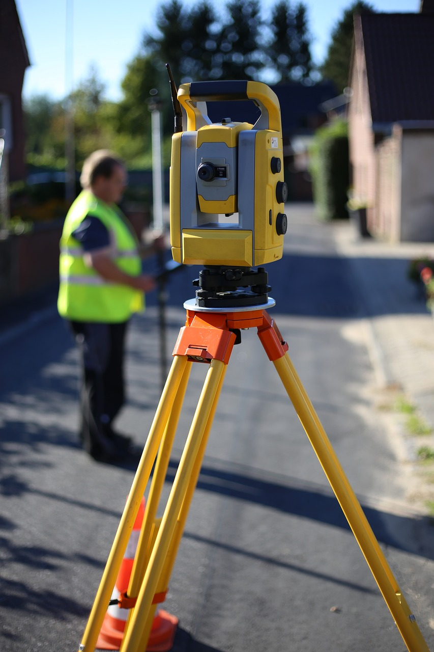
The Role of a Land Surveyor in Pune
A land surveyor in Pune wears many hats. They are part detective, part historian, and part high-tech wizard. Their job involves:
1. Researching historical property records
2. Using advanced surveying equipment like total stations
3. Applying complex mathematical calculations
4. Creating detailed maps and reports
But not all surveyors are created equal. When it comes to private land surveys in Pune, you need someone who understands the local terrain, regulations, and property history.
Types of Land Surveys in Pune
Depending on your needs, there are several types of land surveys you might encounter:
1. Boundary Surveys: Determine the exact boundaries of a property
2. Topographic Surveys: Map the contours and features of the land
3. Construction Surveys: Guide the precise placement of structures
4. ALTA/NSPS Land Title Surveys: Comprehensive surveys for commercial properties
Each type requires specific expertise and equipment, making the choice of your surveyor important.
The Land Surveying Process: A Step-by-Step Guide
Ever wondered what goes on during a land survey? Here's a simplified breakdown:
1. Initial Research: The surveyor studies existing property records and maps.
2. Field Work: Using high-tech equipment, the surveyor takes measurements and identifies key features.
3. Data Analysis: The collected data is processed and analyzed.
4. Map Creation: A detailed map of the property is created.
5. Report Preparation: A comprehensive report is prepared, detailing the findings.
This process can take anywhere from a few days to several weeks, depending on the complexity of the survey.
Here are the details of the Step-by-Step Process:
1. Initial Research
This important first step involves extensive document review and historical research. The surveyor:
- Examines property deeds, titles, and legal descriptions
- Studies previous survey records and plat maps
- Investigates historical land records at local government offices
- Researches adjoining property information
- Reviews zoning regulations and local ordinances
- Checks for any easements or rights-of-way
- Analyzes aerial photographs and satellite imagery
This research provides context for the survey and helps identify potential boundary issues or discrepancies before fieldwork begins.
2. Field Work
This is the on-site phase where surveyors gather precise measurements and data. It involves:
- Setting up base stations for GPS reference
- Using total stations to measure angles and distances
- Employing GPS receivers for precise positioning
- Identifying and verifying property corners and boundaries
- Locating natural and man-made features (trees, structures, utilities)
- Taking photographs for documentation
- Using drones for aerial mapping of larger areas
- Marking boundaries with stakes or flags
- Measuring elevations and creating contour maps if required
Surveyors may also interview property owners or neighbors to gather additional information about boundary locations or historical land use.
3. Data Analysis
After fieldwork, surveyors process and analyze the collected data. This involves:
- Downloading and organizing raw data from survey equipment
- Using specialized software to process GPS and total station measurements
- Comparing field measurements with deed descriptions and historical records
- Resolving any discrepancies between measured and recorded data
- Performing complex mathematical calculations to determine precise boundary locations
- Analyzing topographical data to create elevation models
- Identifying any encroachments or boundary conflicts
- Verifying compliance with local zoning and building regulations
This step is critical for ensuring the accuracy and reliability of the survey results.
4. Map Creation
Using the analyzed data, surveyors create detailed maps or plats. This process includes:
- Using CAD (Computer-Aided Design) software to draft survey drawings
- Creating precise scale drawings of the property
- Depicting property lines, easements, and rights-of-way
- Showing locations of structures, utilities, and natural features
- Including legal descriptions and area calculations
- Adding notes about any special conditions or findings
- Ensuring the map meets local and state standards for survey plats
The resulting map is a comprehensive visual representation of the property and its features.
5. Report Preparation
The final step is compiling a detailed written report. This typically includes:
- A narrative description of the survey process and findings
- Explanation of any boundary discrepancies or issues discovered
- Details of the methods and equipment used
- Copies of relevant historical documents and previous surveys
- The newly created survey map or plat
- Photographs taken during the survey
- Certifications and statements of accuracy
- Recommendations for resolving any boundary issues
- An explanation of any limitations of the survey
This report serves as a legal document and provides a comprehensive record of the survey process and results.
Each of these steps is essential to producing an accurate and legally valid land survey. The process can take anywhere from a few days to several weeks, depending on the complexity of the property and any issues encountered during the survey. The thoroughness of this process ensures that property owners, buyers, and developers have reliable information for decision-making and legal purposes.
Technology in Land Surveying: The Game Changer
Gone are the days of simple chains and compasses. Modern land surveying in Pune employs cutting-edge technology:
1. Total Station Surveys: These electronic theodolites measure angles and distances with high precision.
2. GPS Systems: Satellite technology for accurate positioning.
3. LiDAR: Light Detection and Ranging for creating 3D models of the terrain.
4. Drones: For aerial mapping of large or inaccessible areas.
These technologies have revolutionized the field, making surveys faster, more accurate, and more comprehensive than ever before.
The Cost of Land Surveying in Pune: An Investment in Accuracy
One of the most common questions property owners have is about the cost of a land survey. In Pune, the pricing can vary widely based on several factors:
1. Size of the property
2. Complexity of the terrain
3. Type of survey required
4. Urgency of the project
On average, a basic boundary survey for a residential property in Pune can range from ₹15,000 to ₹50,000. More complex surveys, such as topographic surveys or ALTA/NSPS surveys, can cost significantly more, potentially ranging from ₹50,000 to ₹2,00,000 or higher.
It's important to note that these are rough estimates, and actual costs can vary. Always request detailed quotes from multiple surveyors to get an accurate picture of the costs involved.
Choosing the Right Land Surveyor in Pune
Selecting the right surveyor is crucial for ensuring accurate results. Here are some factors to consider:
1. Qualifications and Certifications: Look for surveyors registered with the Institution of Surveyors.
2. Experience: Prioritize surveyors with extensive experience in Pune's diverse landscape.
3. Technology: Ensure they use modern surveying equipment and techniques.
4. References: Ask for and check references from previous clients.
5. Turnaround Time: Discuss the expected timeline for completing the survey.
Remember, the cheapest option isn't always the best. Investing in a high-quality survey can save you from costly disputes and legal issues down the line.
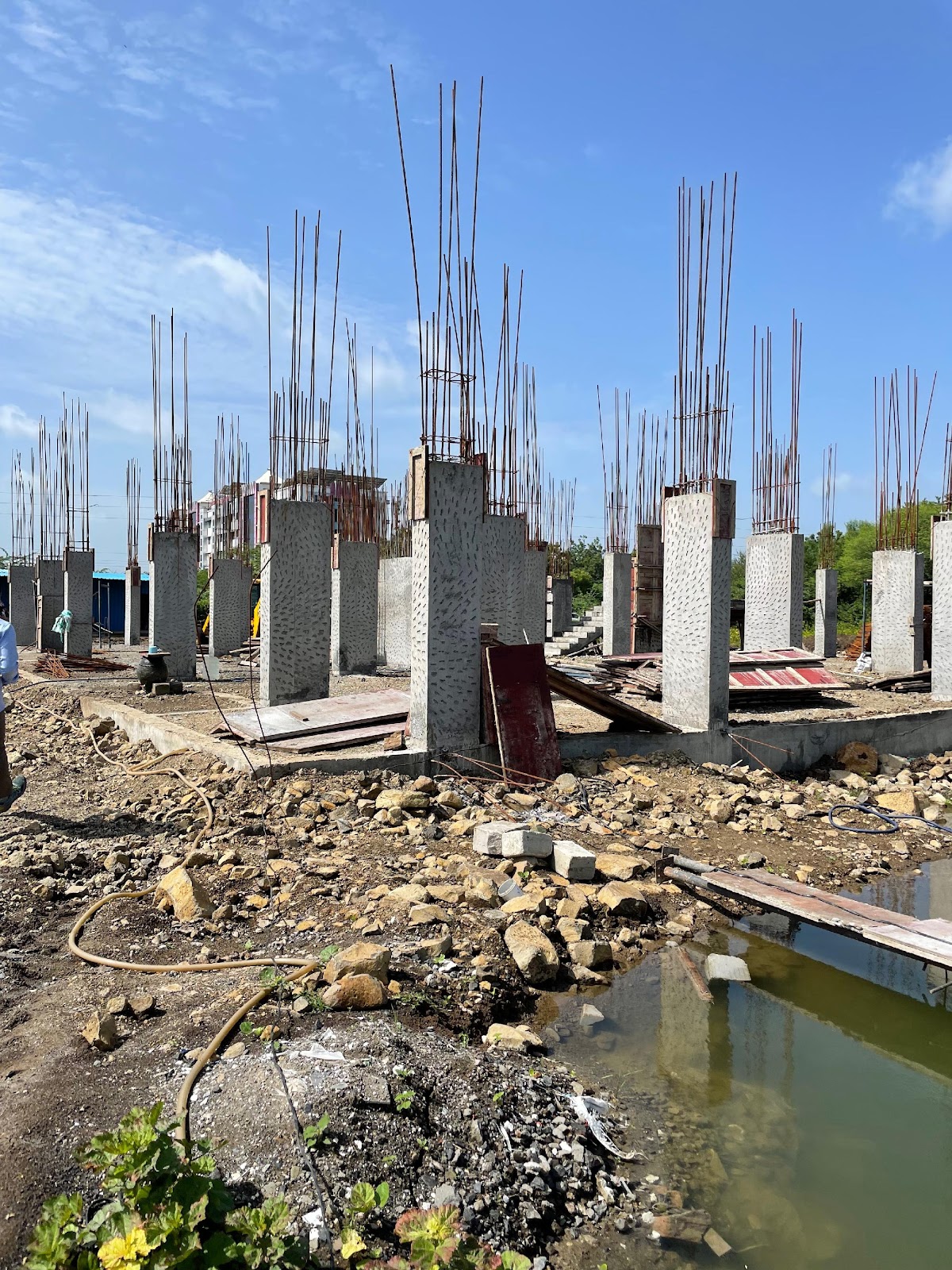
Land Surveying in Civil Engineering: A Crucial Foundation
In the realm of civil engineering, land surveying plays a pivotal role. It forms the foundation upon which all construction projects are built. Here's how surveying in civil engineering impacts various aspects of construction:
1. Site Planning: Accurate surveys help in optimal site utilization.
2. Infrastructure Design: Road alignments, drainage systems, and utility placements all rely on precise survey data.
3. Structural Engineering: Building foundations and structural designs are based on survey information.
4. Environmental Impact Assessment: Surveys help in understanding the project's impact on the surrounding environment.
For civil engineers in Pune, collaborating with skilled land surveyors is not just beneficial – it's essential for project success.
The Future of Land Surveying in Pune
As Pune continues to grow and evolve, so does the field of land surveying. Here are some trends to watch:
1. Increased Use of AI and Machine Learning: For faster data processing and analysis.
2. Integration with BIM (Building Information Modeling): For seamless collaboration in construction projects.
3. Enhanced 3D Mapping Capabilities: For more detailed and interactive property visualizations.
4. Blockchain Technology: For secure and transparent land records management.
These advancements promise to make land surveys even more accurate, efficient, and valuable in the coming years.
Legal Aspects of Land Surveying in Pune
Understanding the legal implications of land surveys is crucial for property owners. In Pune, land surveys play a significant role in:
1. Property Registration: Accurate surveys are required for legal property registration.
2. Dispute Resolution: Survey reports are often used as evidence in property disputes.
3. Compliance with Zoning Laws: Surveys help ensure that construction plans comply with local regulations.
4. Environmental Compliance: Certain surveys are mandated for environmental clearances.
It's always advisable to consult with a legal expert alongside your land surveyor to ensure all legal bases are covered.
The Role of Landscape Surveyors in Pune's Urban Development
While often confused with land surveyors, landscape surveyors play a unique role in Pune's urban development. They focus on:
1. Analyzing the natural features of a site
2. Planning green spaces and recreational areas
3. Assessing environmental impact
4. Designing sustainable landscapes
As Pune strives for sustainable urban growth, the role of landscape surveyors is becoming increasingly important.
Conclusion
Whether you're buying a new property, planning a construction project, or simply want to understand your land better, a high-quality land survey is your first step towards informed decision-making.
Ready to get started with your land survey in Pune? Look no further than Foot2Feet. With our team of experienced surveyors, state-of-the-art technology, and deep understanding of Pune's landscape, we're here to provide you with accurate, reliable, and comprehensive land surveying services.
Visit www.foot2feet.com or call us today to schedule your survey and take the first step towards property confidence.
Frequently Asked Questions (FAQs)
1. How long does a typical land survey take in Pune?
A: The duration can vary widely depending on the size and complexity of the property. A simple residential survey might take 1-2 days, while more complex surveys could take several weeks.
2. Do I need a land survey if I already have property documents?
A: Yes, it's advisable. Property documents may not reflect recent changes or encroachments. A current survey provides up-to-date, accurate information about your property.
3. Can I use GPS on my smartphone for a DIY land survey?
A: While smartphone GPS can give a rough idea, it's not accurate enough for legal or construction purposes. Professional surveyors use specialized equipment for precise measurements.
4. How often should I have my property surveyed?
A: It's recommended to have a new survey done before any property transaction, major construction project, or if you suspect encroachment issues.
5. Are land surveyors in Pune regulated?
A: Yes, land surveyors in India, including Pune, should be registered with the Institution of Surveyors. Always verify a surveyor's credentials before hiring.

Whenever you see a town planning map or a blue print, you come across various terms like open space, amenity space. Here is details explanation in common man’s language for construction related building rules.
FSI (Floor Space Index)
- In general language FSI means permissible built up area on any plot. It is calculated by dividing Built up area by Plot Area.
- FSI = built up area/Plot area.
- E.g. – If permissible FSI for a plot of 1000 Sqft. is 1.10, then we can construct 1100 Sqft. of built up area. (say 225 Sqft on 4 floors or 550SqFt on 2 floors)
- Ducts, Parking floor, basement, architectural treatment are not considered while calculating FSI.
- Depending upon planning authority by-laws, balcony, terrace, staircase, lift, lift machine room are deducted from FSI on payment of premium.
Check FSI in pune https://foot2feet.com/construction-calculator/pmc/fsi-in-pune/
Open Space
- Open space is the space left for recreational activities for the user of that plot. It remains part of the same land under ownership of society.
- Generally we have to leave 10% of total plot area for any building or layout permission.
- Depending upon by-laws smaller plots, gunthewari plots, N.A. plots do not require open space area.
Amenity space
- Generally for plot above 1 acre require 15% amenity space.
- Amenity space is a space to be left for government for planning various public amenities like school, hospital library, fire stations, police chowki etc.
- This space is to be handed over to govt. and owner gets FSI as compensation for land. (In short there is only loss of space but no loss of FSI)
- N.A. plots and smaller plots do not require amenity space.
Paid FSI (Fungible FSI)
- It is additional FSI on any plot after payment of premium amount to planning authority.
- This premium amount depends upon ready reckoner rate of same land.
TDR (Transferable development rights)
- Due to planning authority reservations FSI of one land cannot be utilized entirely on same plot. Hence Government allow plot holder to sell or transfer FSI of his plot. This is called Transferable Development Rights. Buying TDR is like buying virtual land.
- Buyer of TDR can do extra construction on his land.
- One cannot load more TDR than permissible on that land. Maximum Permissible TDR on any plot depends upon Access Road, Land Zone etc…
Checkout The detail information about Transferable Development Rights (TDR) https://foot2feet.com/site/tdr_transferable_development_rights/
Road Widening
- Area of plot falling under proposed or existing road is called as road widening area.
- FSI of this area can be utilized on same plot or converted into TDR.
Carpet area
- Before RERA Carpet area was considered as tile able area in property. It includes room floor area, Balcony area, terrace area, tile area at door jams etc…
- But After RERA (Real Estate Regulatory Act 2016) have modified carpet area concept a bit.
- According to RERA, carpet area include following things
- Room Area
- Internal wall area (wall between 2 rooms of same apartment)
- Dry balcony area (separately mentioned)
- Enclosed Balcony area (separately shown if any)
- Terrace area (separately mentioned) the only difference between RERA carpet & old carpet is that internal wall area is added in RERA carpet.
Built up Area
- Built up area term is most commonly used term in constriction industry. & at same time it has various meaning at various situations. Hence it is necessary to clarify area included or excluded while discussing with built up area. eg –
- For government approvals it is the area covered by a building on all floors including cantilevered portion, mezzanine floors if any but excepting the areas excluded specifically from FSI.
- For buyer / user – It is usable construction area which includes parking, floor area, but excluding footing & foundation area.
- For contractor it is total construction area including parking, 50 % footing, water tank etc.., but excluding top terrace area.
Conveyance Deed
Any construction consists of 2 most important factors first is b.up area & 2nd is land on which building is constructed. After completion of construction builder/developer was supposed to transfer land in name of society (or association of apartment). This transfer process is called as conveyance deed. A survey shows that in almost 80% society this process was not completed.
You can check the more information about conveyance deed here https://foot2feet.com/construction-services/legal-services/conveyance-deed/
Building Control Line
It is the line up to which we can build construction according to planning authority / or any government authority.
Non Agriculture (NA)
- Any land (except land in Gaothan area) is by default agriculture land in India. It is assumed as non-agriculture land only and only after taking NA permission (Non Agricultural use permission) from collector.
- A copy of land conversion is called as NA order.
- For NA land zone plays important role. (Agriculture, industrial , residential)
- Depend upon zone NA can be done. Eg – Industrial NA, farmhouse NA, residential NA, commercial NA.
- NA and R-zone are commonly misunderstood.
- In simple words, NA is procedure to change tax on any land due to change in use of land.
- NA land not necessary to be residential land all time, and similarly residential land not necessarily to be NA land.
- A land which is in residential zone, but its use according to collector/revenue department is agriculture, then the land is not NA. (but this land can be converted into NA after completing NA procedure.)
You can Check more information about Non Agriculture here – https://foot2feet.com/site/na_order_land_conversion/
Side Margin
Side margin is distance to be kept from plot boundary to building line as per Regulations. Calculate how much side margin you need to keep for your building.
https://foot2feet.com/construction-calculator/pmc/side-margin-calculator/
Ready Reckoner Rate
Government rates of land, property is called as ready reckoner rate. These rates are published and regulated by the respective state government. Find Out Ready Reckoner Rates in Pune here – http://www.igrmaharashtra.gov.in/eASR/frmMap.aspx
R zone (residential)
It is a zone demarcated as residential area in development plan mostly it shown in yellow color any agriculture land cannot converted in residential zone it agriculture / vanikaran land must pass certain criteria for zone conversion. you can use our site feasibility service to know whether your land can be converted or not.
You can check all Types of Land zone
https://foot2feet.com/blog/types-of-land-zone-its-benefits/
Residential zones – R1 / R2
- Residential Zone R1 includes Residential plots abutting on roads below 9 m. in congested area and below 12 m. width in outside congested area
- Residential Zone R2 includes Residential plots abutting on road having existing or proposed width 9 m. and above in congested area and 12 m. and above in outside congested area

UDCPR 2020 Chapter 9 is all about the Requirements of Part of the Building as per mentioned in the UDCPR
This is Applicable to all Planning Authorities and Regional Plan Areas except Municipal Corporation of Greater Mumbai, Other Planning Authorities/Special Planning Authorities/ Development Authorities within the limit of Municipal Corporation of Greater Mumbai, MIDC, NAINA, Jawaharlal Nehru Port Trust, Hill Station Municipal Councils, Eco-sensitive/Eco-fragile region notified by MoEF & CC and Lonavala Municipal Council, in Maharashtra.
Rule No. 9.12 Ramp
9.12.1 Non Vehicular Ramp
All the requirements of stairways in Regulation No.9.28.8 shall apply mutatis mutandis to non-vehicular ramps. In addition, the following requirements shall be complied with.
a) Ramps with a slope of not steeper than 1 in 10 may be substituted for and shall comply with all the applicable requirements of required stairways as to enclosure, capacity, and dimensions. In certain cases, steeper slopes may be permitted but in no case greater than 1 in 8 shall be permitted. Ramps shall be surfaced with approved non-slipping material. Provided that in the case of public offices, hospitals, assembly halls, etc. the slope of the ramp shall not be more than 1 : 12.
b) The minimum width of the ramps in hospitals shall be 2.25m.
c) Handrails shall be provided on both sides of the ramp.
d) Ramps shall lead directly to outside open space at ground level or courtyards or safe places.
e) For buildings above 24.0 m. in height, access to ramps from any floor of the building shall be through a smoke stop door.
f) When there is a difference in level between connected areas for horizontal exits, ramps with no more than 1 : 10 slope shall be provided; steps shall not be used.
g) In the case of non-special buildings, ramps may be permitted inside marginal distances. In the case of a special building, ramps may be permitted in side marginal distances, after leaving 6.0 m. marginal distance for movement of fire fighting vehicle.
9.12.2 Ramp to basements and upper storeys for vehicles
For parking spaces in the basement and upper floors, at least two ramps of minimum 3.0 m. width with a slope not more than 1 : 8 shall be provided, preferably at the opposite ends. Instead of two ramps, one ramp of 6.0 m. width may be allowed. In addition to these, the owner may provide car lifts if he desires to do so.
If the ramp is proposed to be used only for two-wheelers, then at least two ramps of 2.0 m. width with a slope not more than 1 : 8 shall be provided, preferably at the opposite ends. Instead of two ramps, there is one ramp of 4.0 m. width may be allowed.
In the case of a plot admeasuring 1000 sq.m. or less, only one ramp of 3.0 m. may be provided for car/two-wheeler parking, or one ramp of 2.0 m. may be provided for two-wheeler parking or the owner may provide a minimum 2 Car lifts instead of Ramp.
In the case of a plot measuring up to 2000 sq.m., one ramp of minimum 6.0 m. width may be provided for car/two-wheeler parking or the owner may provide a minimum of 2 Car lifts instead of a Ramp.
Note - Sub Regulation No. 9.12.1(g) shall also be applicable in this regulation.
Rule No. 9.13 Podium
Podium for parking of the vehicles and other uses mentioned herein, may be permitted with the following requirements/conditions:
i) The height of the podium shall be at least 2.4 m. from the floor to the soffit of the beam.
ii) Podium may be allowed at a distance of 6.0 m. from the front, side, and rear of the plot boundary in case of a special building, subject to provisions of Regulation No.6.2.3(c).
iii) The podium shall be designed to take a load of fire-engine if required.
iv) Recreational open space may be permitted on the Podium subject to regulation No.3.4.1(iii). The structure mentioned in Regulation No.3.4.7 may be permitted over the podium on which recreational open space is provided, subject to 15% of the area of such recreational open space.
v) Podium shall be permissible joining two or more buildings or wings of buildings, subject to the availability of manoeuvring space for a fire engine. In such case, the distance between two buildings/wings of the building shall be provided as otherwise required under these Regulations.
vi) Part of the podium may be used for recreation or play areas for schools.
vii) Part of the podium may be used for clubhouses subject to Regulation No.3.4.7(i).
Related Regulations to Rule No. 9
Habitable Rooms as Requirements of Part of Building in UDCPR 2020
Basements as Requirements of Part of Building in UDCPR 2020
Balcony as Requirements of Part of Building in UDCPR 2020
Provision of Lift as Requirements of Part of Building in UDCPR 2020
Lighting and Ventilation of Room as Requirements of Part of Building in UDCPR 2020
Compound Wall and Other Requirements of Part of Building in UDCPR 2020

Introduction
Construction in India involves a multitude of different factors. These factors involve the purchase of land, design procedures, permissions, construction, and post-construction operations and maintenance. For any construction project to be successful, the most important aspect is it’s finance. Project/ Construction budgeting is an essential element of a construction project and it’s management.
What is the construction budget?
A construction budget is an estimate of overall costs incurred during the construction of a building. A construction budget involves every cost essential for the completion of a project. The construction budget is the allocation of resources majorly money with other resources such as Man, materials, machinery, and time required for the completion of a project in a specified time.
Why is construction budgeting important?
A budget provides a glimpse of a project’s viability, sustenance and it’s success. Analyzing finances before the start of a project gives an upper hand in terms of overall financial planning, and decision-making regarding the quality and quantity of the project. Here are a few reasons why construction budgeting is important:
- Financial budgeting: Budget creation allows an individual to plan expenses across the timeline of a project and allocate funds accordingly. It helps in setting realistic goals and keeping track of expenses.
- Control over cost: As the budget is decided minutely, one can have control over expenses. One can prevent unnecessary expenses, make informed decisions, and hold onto cost-saving opportunities.
- Prioritising needs and wants: Budgeting will help allocate funds according to priority to the most essential. It helps in understanding the need for certain expenses and getting rid of unnecessary wants according to the budget.
- Avoiding pitfalls: A project spans for longer than a year and there can be certain surprises and expenditures during the construction. A well-planned budget helps to avoid such unexpected costs. It helps to plan the cost of contingencies that may arise during construction.
Steps to create a construction budget
- Project Research: The first step is to analyse the project goals and requirements. Evaluate the project feasibility by checking site conditions, zoning, permit requirements, location, and availability of construction materials.
- Project Scope: Meet with engineers and architects to determine the scope and design options for the project. Create a detailed list of materials that will be needed. Reach out to contractors and suppliers to check with material costs and supply timeline.
- Pre-construction and documentation: Before initiation of construction,
- Meet all the stakeholders to discuss the project, material list, and cost overheads.
- Document these and create an intensive list of items, their costs, supply timelines construction timelines to avoid overruns, and reduce risks during construction.
- Make use of technology by having templates made by project management professionals for the creation of a construction budget.
- Construction and close-out: Keep track of the budget during the construction phase. Monitor actual costs against projected costs. Identify any issues and change any deviation according to budget or schedule. Keep track of deliverables from contractors and suppliers to make timely payments and have a closure to the project.
How to do construction budgeting?
There are different approaches to the process of budget making.
- Bottom-up/ Unit cost estimation: In this method of estimation, the work is divided into small work heads. A unit price is established for each piece. The unit price is then multiplied by the required quantity to find the cost of that head. This method provides the most accurate results of projected construction costs.
For example, the cost to build a brick wall can be accurately determined by finding the number of bricks required and estimating all costs related to delivering, storing, staging, cutting, installing, and cleaning the brick along with related units of accessories such as reinforcing ties, weep-holes, flashings.
- Top-down/ Assembly estimation: In this method of estimation, the cost is calculated based on the previous project cost which is similar in nature of construction.
For example, if there is a residential project with piles footing to be done, the cost is estimated by referring to the construction cost of earlier completed similar projects for that head. Usually, this is not much reliable due to different factors like a timeline of both projects, fluctuating material costs, labour cost.
- Parametric estimation: This method of estimation uses historical data to calculate the resources needed. This method uses more project data of similar building types to estimate the construction cost along with specifications of materials with their costs. This estimating method requires the assumption of an approximate gross area for the proposed work and a sufficient historical record of similar building types.
- Square foot estimation: In this method of estimation, the cost of the overall project is calculated based on the square feet area of the project built-up. The estimation requires data from previous similar construction types with proper and sufficient knowledge as well as experience of the construction field.
Factors to consider for construction budgeting
- Property: One of the most important factors is the property. The rate of property varies based on it’s location, project scope, and vicinity. The land value is not just the value of property but also includes the cost of acquisition if there’s any. The property cost is a capital cost that is one-time investment. To calculate the overall budget of the project, the projection of this capital cost plays a very important role.
- Fees and services: A construction project requires a wide range of professional consultations and services. Depending on the scope, size, and requirement, one may be required to hire professionals including architects, engineer, landscape architect, Mechanical Electrical Plumbing consultant, surveyor, project manager, interior designer and many other consultants. Hiring professionals will incur service costs that are to be taken into account while working on the budget.
With service costs, there are also fees that includes registration fees, building permission fees, occupancy certificate fees, No objection certificates, and other government service fees.
It is important to get highly detailed construction drawings for accurate estimation. Depending on the scale of project, the service fees to service provider may increase, and also other government costs may increase as well.
- Design: The cost of project depend on it’s design, soil conditions and use. Based on the design of project, the cost can vary. Like larger span between columns may give you bigger spaces but the steel design becomes heavy. So, finding balance between design and technicality is important.
For example, with extended cantilevers, the steel and concrete design will increase leading to increase in construction cost.
Also, based on soil conditions, type of foundation will be decided which will further affect the cost of construction.
- Material: Material accounts for one of the most significant parts of the construction budget. The material required for the construction varies as per the stage of construction. The list of materials is extensive some heads common for most construction projects and with some heads that are project-specific based on design requirements.
The cost of a few materials is fixed while some materials have fluctuating costs based on market value, it is important to study the trends of that specific material and calculate the average cost for such materials.
Sourcing materials from reputable suppliers ensures quality construction and longevity of the project. Also, the procurement cost of materials depends on the accessibility of location.
Make a intensive list of all the materials from site preparation to beautification of the project including foundation, structural costs, interior finishes and fixtures, external works, and landscaping.
- Labour: Any construction project to be completed, labour is a fundamental aspect. Hire contractors, sub-contractors, labour according to the requirement on site. One of the most challenging aspect of cost estimation is calculating construction labour costs. When calculating labour budget, keep in mind the true cost of human resources, including:
- Hourly wages both for employees and subcontractors
- Workers’ compensation costs and payroll expenses for employees
- Non-productive time and re-work, though these costs can also fall under a contingency budget
RCC contractors charge 10% of the project cost, electrical contractors charge based on square feet area of project, plumbing contractors charge based on number of toilets, Landscape contractors charge based on cost of plants/trees, structural consultant charge between INR 3 to INR 10 per square feet of slab area.
- Equipment and Tools: There are two ways this cost can be calculated. One if the contractor provides equipment and tools, the cost will be considered accordingly whereas if you plan to purchase equipment then the cost of equipment and tools have to be calculated separately. For large-scale projects, heavy equipment can be rented, and rental costs based on location and time should be calculated.
There could be operating costs, and fuel costs for certain equipment which should be taken into account.
- Management & Technology: Construction projects require people who can manage the project technically. These members require their own equipment and supplies to perform their jobs. Salaries, office rent, and utilities have to be included in the construction budget. Security staff, safety supplies, and all other support roles and materials are also part of project management costs.
There are new technologies for project management and construction. Many companies today use project management, accounting and scheduling software. These soft costs aren’t directly related to physical construction, but they are critical expenses you incur to get the job done.
- Utilities & Taxes: As per the scale of the project, utilities have been installed on the project site like water, electricity, sewage, and gas. These utilities have their permit and service fees that must be factored into the overall construction budget.
The construction project will be subjected to local and state level taxes. Tax rates depend on the scope and type of construction, with larger construction investments subject to more tax. Be sure to work with a certified professional accountant who is experienced in construction finance to ensure you’re properly accounting for all taxes.
- Contingency: Even after accurate and technical planning of the budget, there will be surprises and unexpected scenarios during construction. It’s crucial to include a contingency budget in the overall construction budget. A contingency budget is funding set aside to pay for unexpected expenses that arise once the project gets started. A contingency fund isn’t allocated to any particular category of costs.
A contingency budget is usually between 5% and 10% of the project’s total budget.
- Insurance and bonds: Construction projects legally required to carry insurance. There might also be a deposit or bond required as a show of faith that your company is going to follow through and ensure all subcontractors, tradespeople, and suppliers are paid. This is especially true if working on a governmental project.
Things to avoid when planning the construction budget
- Inaccurate estimates: While planning the construction budget, estimates are to be planned according to current market prices. It is important to study the market cost and have accurate costings.
- Poor quality: While estimating, usually one tends to look for the cheapest option. But one needs to be careful of the quality of the material.
- Miscommunication: During the process of making the budget and after, communication plays an important role. The contractors, labour, managers, and suppliers must be in the communication loop for the timely and successful completion of the project.
- Delays: Even after making an accurate construction budget, the cost of a project can go haywire if there are project delays. Natural delays are beyond our control but one must avoid delays due to decision-making, procurement delays.
The construction cost per square foot in India in 2024 is influenced by a multitude of expenses ranging from land acquisition and design fees to material costs, labor expenses, structural elements, interior finishes, and external works. It is important to understand the detailed list of expenses that are involved in construction. Careful planning, budgeting, and managing expenses can ensure the successful completion of their project with their decided budget constraints.
It’s not just about creating a budget; it’s about following it, reviewing it regularly, and amending it when necessary. After all, a comprehensive construction budget is dynamic and must serve as an active financial management tool throughout the span of your project!

UDCPR 2020 Chapter 9 is all about the City Specific Regulations as per mentioned in the UDCPR
This is Applicable to all Planning Authorities and Regional Plan Areas except Municipal Corporation of Greater Mumbai, Other Planning Authorities/Special Planning Authorities/ Development Authorities within the limit of Municipal Corporation of Greater Mumbai, MIDC, NAINA, Jawaharlal Nehru Port Trust, Hill Station Municipal Councils, Eco-sensitive/Eco-fragile region notified by MoEF & CC and Lonavala Municipal Council, in Maharashtra.
Rule No. 10.13 Bhiwandi Surrounding Notified Area
10.13.1 Regulations for Affordable Housing Scheme:
1. In order to promote the construction of affordable housing stock on private lands, the Planning Authority may permit the implementation of the Affordable Housing Scheme in accordance with the provisions of these Regulations. Affordable Housing Scheme (hereinafter referred to as 'the Scheme') shall be permissible only on the lands situated within the limits of the Bhiwandi Surrounding Notified Area in the Mumbai Metropolitan Region (MMR).
2. (i) Affordable Housing Scheme shall be permissible in the Residential Zone/Affordable Housing Zone shown on the Development Plan only and on plots having access from an existing or proposed Development Plan Road having width equal to or in excess of 18.0 m., or an existing road in respect of which Regular Line of Street has been declared under the relevant provisions of Maharashtra Municipal Corporation Act, Maharashtra Municipal Councils, Nagar Panchayats and Industrial Townships Act, 1965 for a width of 18.0 m. or more, provided permissible FSI on such plots is 0.95 or more and TDR/additional FSI on payment of premium more than 0.6 is allowable. However, in the case of a proposed road, the land under the said proposed road shall be acquired before the approval of building plans for the Affordable Housing Scheme. Affordable Housing Schemes shall not be allowed in areas where FSI is less than 0.95 or where the use of TDR is not permissible.
(ii) Minimum plot area for the Affordable Housing Scheme shall be 4000 sq. mt. excluding area under D.P. Roads and D.P. Reservations, if any.
(iii) The plot under the Scheme shall be independent, unencumbered, and contiguous.
(iv) The Scheme shall not be permissible in congested areas, demarcated as such on the Development Plan.
3. The Special Planning Authority for Bhiwandi Surrounding Notified Area shall be competent to grant both location clearance and layout approval/building permission for an Affordable Housing Scheme.
4. (i) Maximum permissible FSI (including the base FSI of 1.00) under the Scheme shall be 3.00 on the gross plot area, including mandatory layout recreational open space and Amenity Space. The FSI to be utilized shall be in the proportion of 1:3 for the Affordable Housing Component and the Free Sale Housing Component on 1/4th and 3/4th part of the land respectively. Thus, affordable housing and free sale housing shall be proposed on the same plot of land but in two separate, independently buildable pockets. For lands in Affordable Housing Zones, the owner/developer may be allowed to develop the land as per the Rules of the Affordable Housing Policy with the proviso that the free sale to Affordable Housing FSI ratio will be 1.8:1 instead of 1.66:1 and the maximum FSI will be 2.5. Or
The owner/developer may be allowed to develop the land as permissible in the Residential Zone as per prevailing Development Control Regulation subject to the condition that the area of tenements to be constructed with the entire potential of the land, shall be of Affordable Housing Scheme. However, if the provisions of inclusive housing stipulated in UDCPR are applicable to this area then, it shall also be made applicable to such land.
(ii) Under the Affordable Housing Scheme, up to 15% of the total built-up area of the Affordable Housing Component may be used for the construction of shops/commercial use as per the direction of the Special Planning Authority for Bhiwandi Surrounding Notified Area and such commercial built-up area shall be handed over to the Special Planning Authority for Bhiwandi Surrounding Notified Area free of cost.
5. (i) An Affordable Housing Unit shall be a self-contained dwelling unit of 25 sq. mt, carpet area, However the carpet area of a Housing Unit shall be 160 sq.ft., where the construction under the Rental Housing Scheme has already commenced.
(ii) The amenity space for Affordable Housing shall be 10% of the gross plot area under the Scheme and it shall be proportionately provided in the area earmarked for the Affordable Housing Component and the Area kept for the Free Sale Housing Component.
Provided that where the Scheme is to be implemented on a plot in an Industrial Zone where the Planning Authority has duly permitted Residential users under the relevant provisions of the Development Control Regulations :-
No further area shall be required to be kept as amenity space under Regulation 5(ii) for the Scheme if the area prescribed to be kept as amenity space while permitting residential users in the Industrial zone is equal to or more than 10% of the gross plot area.
only the balance area shall be required to be kept as amenity space under Regulation 5(ii) for the Scheme if the area of amenity space prescribed by the Planning Authority, while permitting residential users in the Industrial zone, falls short of 10%.
(iii) Notwithstanding anything contained in the relevant provisions of the Development Control Regulations of Amenity Space in general, and also regarding permitting Residential User in Industrial Zone, it shall be obligatory on the Developer/Owner to develop the amenity space for users (hereinafter referred to as prescribed amenity users) such as School, Play Ground, Garden, Health Care Facilities, Multipurpose Hall, Auditorium, etc. with the approval of Chief Executive Officer of Special Planning Authority, as per the specifications prescribed by the said Authority, subject to the condition that at least 50% of such amenity space shall be kept for open users, before seeking Occupancy Certificate for the Free Sale Housing Component of the Scheme, failing which the land under such amenity space shall be handed over free of cost to the Planning Authority and such land shall be developed by the Chief Executive Officer of Special Planning Authority for the aforesaid prescribed amenity users only.
No compensation in the form of TDR shall be admissible to the Owner/Developer for
development of such prescribed amenities under this Regulation.
(iv) Irrespective of whether the Owner/Developer develops the prescribed amenity users as
per the provision of Clause (iii) above or fails to do so, the process of handing over the land under such amenity space, along with the developed prescribed amenities, where such prescribed amenities have been developed, shall be completed within one month from the date of application by the Developer / Owner for seeking Occupancy Certificate for the free sale Housing Component of the Scheme and if such handing over process is not completed within the said period, the occupancy Certificate for the free sale Housing Component of the Scheme shall be withheld by the Chief Executive Officer of Special Planning Authority, till such amenity space, along with developed prescribed amenities, where such prescribed amenities have been developed, is handed over to the Planning Authority.
(v) Under the Affordable Housing Scheme, there shall be a welfare hall and a Balwadi at the rate of 30 sq.m. for every multiple or part of 200 residential units and an office for Managers/Co-operative Housing Society at the rate of 30 sq.m. per every multiple or part of 500 residential units which shall be treated as a part of Affordable Housing Component and shall not be counted towards the FSI while computing 3.00 FSI on the site and shall be given along with layout / DP roads and shops, free of cost to the Special Planning Authority for Bhiwandi Surrounding Notified Area. These facilities shall be constructed at locations as suggested by the Special Planning Authority for Bhiwandi Surrounding Notified Area and shall be transferred free of cost to it.
6. Under the Affordable Housing Scheme, Off-Site Infrastructure Charges at the rate of 5% of the land rate as given in the Annual Statement of Rates (ASR) prepared by the Inspector General of Registration, Maharashtra State, for the year in which Commencement Certificate is issued, subject to a minimum of Rs.2000 per sq.m., shall be paid by the Developer for the built-up area, over and above the normal permissible FSI. This amount shall be paid to the Special Planning Authority for Bhiwandi Surrounding Notified Area. Release of FSI under the Scheme shall be as follows :-
7. Release of FSI under the Scheme shall be as follows :-
FSI for Affordable Housing Component and the Free Sale Housing Component under the Scheme shall be released in accordance with the following Table :-
| Sr. No. | Stages of Release FSIcompleting | Affordable Housing Component* | Free Sale Component* |
|---|---|---|---|
| 1 | On Grant of Building Permission / Commencement Certificate up to plinth by 1.1-L- B Special Planning Authority for Bhiwandi Surrounding Notified Area / Planning Authority to the Affordable Housing Project. | 3.00 | 1.00 |
| 2 | On Completion of 50% BUA of Affordable Component | - | 0.75 |
| 3 | On Completion of 100% BUA of Affordable Component | - | 0.75 |
| 4 | On handing over of 25% of the land and completed Affordable Housing Component buildings with an Occupancy Certificate. | - | 0.50 |
| Total | 3.00 | 3.00 |
Explanation - The FSI of 3.00 is to be calculated on one-fourth of the plot area for the Affordable Housing Component as well as three-fourths of the plot area for the Free-Sale Housing Component.
8. The Affordable Housing Component under the Scheme shall be handed over along with the 1/4th part of the total plot of land, free of cost to the Special Planning Authority for Bhiwandi Surrounding Notified Area.
9. (i) The affordable Housing stock created under the Scheme shall be allotted by the Special Planning Authority for Bhiwandi Surrounding Notified Area as follows :-
| Percentage | Allotment to | Category of stock | Rate of Allotment |
|---|---|---|---|
| 25 | Special Planning Authority for Bhiwandi Surrounding Notified Area for use as PAP tenements or Staff Quarters or Transit Accommodation, | Ownership | Free of Cost |
| 25 | Outright sale to Govt. of Maharashtra and its statutory bodies/Govt. undertakings for use as PAP tenements or staff quarters or Transit Accommodation. | Ownership | As per the Construction rate of ASR |
| 50 | Outright sale as affordable housing by MHADA is subject to the general or specific directions of the Government. An outright | Ownership | Free of Cost to MHADA which shall dispose of the same as per its pricing policy and by draw of lots |
(ii) The Affordable Housing stock shall be disposed of as per the prevailing policy of MHADA regarding pricing and disposal of its housing stock meant for affordable housing. Each Project approved under the Scheme Shall be brought to the notice of the Government of Maharashtra and its statutory bodies/Government undertakings by means of Press Advertisement. If the Government of Maharashtra or any of its statutory bodies/Government Undertakings doesn't place a firm requirement for the housing stock earmarked for them in the Scheme before the Completion Certificate/Occupation Certificate for the said Scheme is issued, the same shall come to the share of MHADA for outright sale as per the Prevailing Policy of the MHADA.
10. (i) The other aspects of the Development of Affordable Housing Scheme, not specifically dealt with hereinabove, shall be as per the relevant provisions of the Development Control Regulations of the respective Planning Authority.
(ii) It shall also be permissible for the Developer/Owner to utilize the FSI available for Free Sale Housing Component, fully/partly for any other user otherwise permissible as per the Development Plan and Development Control Regulations.
(iii) In case, owing to genuine hardship and site conditions, relaxation in marginal open spaces is sought by the Developer/Owner, the Chief Executive Officer of the Special Planning Authority may consider such request, using his discretionary powers under the Development Control Regulations, subject to the condition that in no case shall the clear marginal open space reduced below 6.0 m. No premium shall be charged for granting such relaxation in marginal open space in respect of the Affordable Housing Component of the Scheme.
11. No project under the Rental Housing Scheme envisaged under the said directives issued by the Government vide orders dated 6th August, 2008, 25th August, 2009, 4th November, 2008 and August 2008 shall be permitted after the date on which the Notice No.TPS-1212/ 79/CR-60/12/ UD-12, Dated 30th November, 2013 regarding this Regulation Under section 37(1AA) of the Maharashtra Regional and Town Planning Act, 1066 was published in the official (hereinafter referred to as 'the cut cat date')
Provided that the Rental Housing Projects in respect of which Location Clearance had been granted by MMRDA, but Commencement Certificate has not been issued by the concerned planning Authority, shall be allowed to continue, as such, in case such project proposals are resubmitted to MMRDA within a period of 31 days from the date of this Notification in the Official Gazette. All such project proposals received by MMRDA within the prescribed time limit shall be scrutinized by MMRDA on merit and to be submitted for the prior approval of the State Government for their continuance under the Rental Housing Scheme.
Provided further that the Rental Housing Projects already approved may be allowed to be converted into Affordable Housing Projects under the provisions of this Regulation, with prior approval of the State Government.
Related Regulations to Rule No. 10
Special Rules for Pune City in UDCPR 2020
Thane Municipal Corporation Area in UDCPR 2020
Special Rules for Nagpur City and Nagpur Metropolitan Region Development Authority in UDCPR 2020
Nashik Municipal Corporation in UDCPR 2020
Vasai Virar City Municipal Corporation in UDCPR 2020
Kolhapur Municipal Corporation in UDCPR 2020
Navi Mumbai Municipal Corporation in UDCPR 2020
CIDCO Area Excluding Naina Area in UDCPR 2020

UDCPR 2020 Chapter 14 is all about the Special Schemes as per mentioned in the UDCPR
This is Applicable to all Planning Authorities and Regional Plan Areas except Municipal Corporation of Greater Mumbai, Other Planning Authorities/Special Planning Authorities/ Development Authorities within the limit of Municipal Corporation of Greater Mumbai, MIDC, NAINA, Jawaharlal Nehru Port Trust, Hill Station Municipal Councils, Eco-sensitive/Eco-fragile region notified by MoEF & CC and Lonavala Municipal Council, in Maharashtra.
Rule No. 15.2 Erection of Mobile Towers
Erection/setting up Telecommunication Cell Sites/Base Stations and installation of the equipment for the Telecommunication network shall be permissible as per the norms of the Department of Telecommunication/Information Technology or the concerned Department of the Central/State Government.
Rule No. 15.3 Preparation of Local Area Plan
A local area plan is a plan for the comprehensive development of a particular area in a city/town, which may consist of more detailed provisions than that of a development plan addressing the local requirements of the area. The Authority may prepare such a plan consisting of planning requirements at a micro level, local area-specific regulations, urban design, etc. The local area plan shall be prepared by following a procedure similar to that of section 33 of the Maharashtra Regional and Town Planning Act, 1966. After approval of this plan by the State Government, it shall come into force. In the event of provisions of the local area plan not consistent with UDCPR, the provisions of the local area plan shall prevail.
Rule No. 15.4 Guidelines for Street Design in City/Town
The authority shall ensure the complete design of streets i.e. streets shall be designed to cater to the needs of all users and activities like smooth and convenient vehicular movement, safe and unhampered pedestrian movement for all age groups, safe and easy movement of differently-abled persons, street furniture, etc.
The street shall generally be designed to
i) Attract more users
ii) Have provisions for pedestrian and cyclist
iii) Increase retail activities
iv) To provide relevant street furniture and signage
v) Plant trees
vi) Make provisions for proper illumination
vii) Have provisions for underground utilities.
Related Regulations
You can visit our other blogs related to Regulations 15 through the below-mentioned links:
Quarrying Operations in UDCPR 2020